Haddam, Killingworth and the lower valley
Landing settlements, shipbuilding, farmland that reverted to woods, and a housing stock spread thin along the roads.
The lower valley towns were organised by the river before they were organised by anything else. Settlement clustered where a landing was possible and a road could reach it, which in this stretch means a series of small centres strung along the bank rather than a single dominant village. Between them the land rises quickly into ledge and woodland, and that topography has shaped the housing ever since.
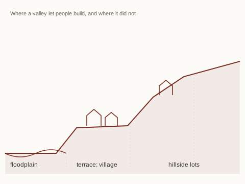
What the river built
Through the eighteenth and nineteenth centuries the valley's economy was water-borne: shipbuilding and repair, fishing runs in season, timber and stone moving downstream, and small mills on the streams that fed the river. Each of these left housing behind in a particular pattern, a handful of substantial houses near the landing and smaller ones behind them, and left it in the places where the work had been rather than where a planner would have put it.
When the river trade declined the settlements did not disperse; they simply stopped growing. That is why the centres here read as complete small villages of their period rather than as fragments, and why the surrounding countryside contains isolated farmhouses on roads that no longer lead anywhere in particular.
Farmland that became forest
Much of the cleared land in these towns went back to woodland across the late nineteenth and twentieth centuries as farming moved west. The stone walls now running through mature forest are the boundaries of fields nobody has ploughed in a century. For anyone reading a parcel here this matters practically: boundaries frequently follow walls, walls have been rebuilt and robbed, and descriptions written when the land was open can be difficult to walk when it is not.
Housing character
The result is a stock with two clear poles. In the village centres there are eighteenth and nineteenth-century houses on small lots, often close to the road, with the constraints that come with that age: shallow or stone foundations, additions made in several campaigns, and heating systems installed into buildings never designed for them. Away from the centres there is low-density building of the twentieth century on large wooded lots, nearly all of it on private wells and septic systems.
Land rules reinforce this pattern rather than moderating it. Where zoning requires large lots and the terrain limits where a septic system can go, new houses arrive slowly and are large when they do. The small village house, which is what many people actually want here, is a fixed and non-reproducible supply.
What to look at in this landscape
Three things repay attention in the lower valley: water, access and boundaries. Water means both the well and the septic system, and where a parcel sits relative to wetland and flood mapping. Access means whether the road is public or private, and who maintains it in winter. Boundaries mean whether the recorded description can still be walked. None of these are unusual questions here; they are simply the ordinary ones for rural land.